
Eyes in the Sky: How CLERC Is Using Drones to Support Fire Resilience Across Lake County
If you've driven through parts of Lake County and noticed stretches of roadside that look a whole lot healthier and more open than they used to, you already know that CLERC's Fire & Forestry Program has been busy. But what you might not know is that some of the planning behind that work starts hundreds of feet in the air.
CLERC has added a drone program to its growing toolbox of fire resilience and forest health initiatives, and it's changing the way we prepare for, manage, and document the vegetation management projects happening across the county. Here's a look at what that means and why it matters.
What Exactly Is a Drone Doing Out There?
Great question. Before our contractors ever set foot on a project site, it helps to know exactly what they're walking into. What does the terrain look like? How dense is the vegetation? Where are the steepest slopes, the thickest brush, the areas that need the most attention?
Satellite images can give you a general idea, but they only go so far. They're often outdated, and you just can't zoom in enough to see what's really going on at ground level. By flying a drone over a project area and capturing overlapping aerial photographs, we can stitch those images together into what's called an orthomosaic, a single, highly detailed, birds-eye-view image of the landscape that tells us way more than anything you'd pull up on Google Earth.
Wait, What's an Orthomosaic?
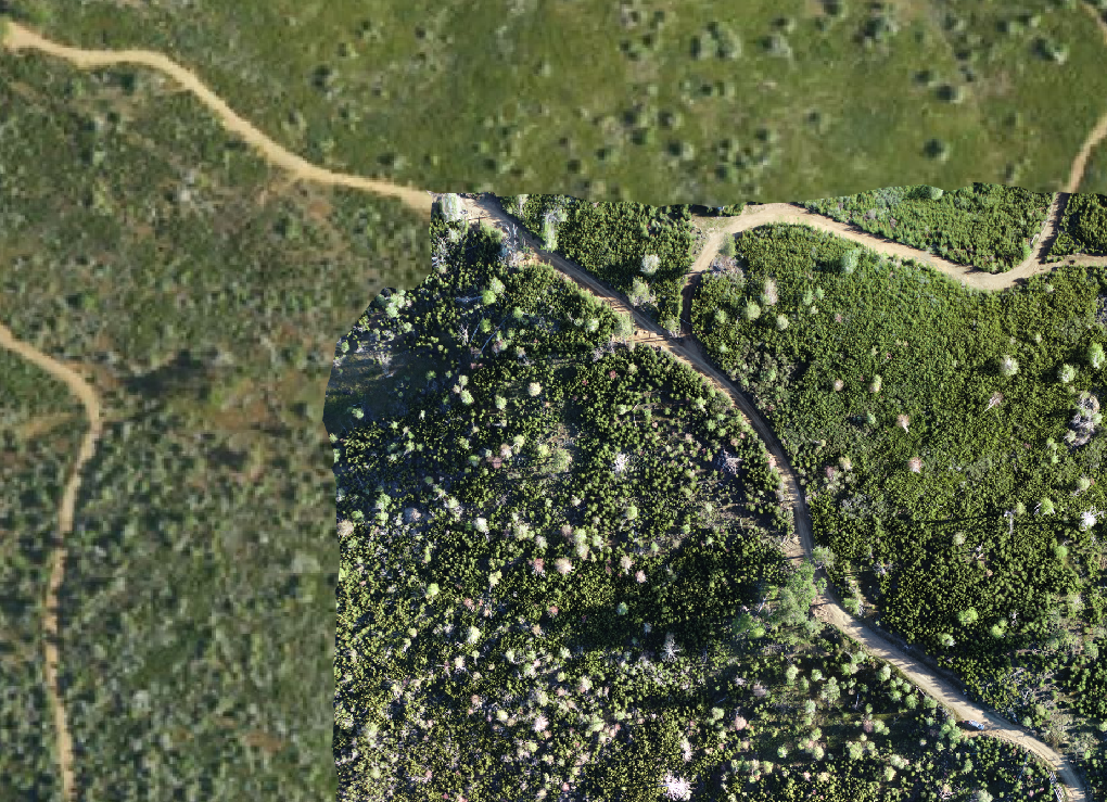
Satellite detail versus drone footage gathered detail.
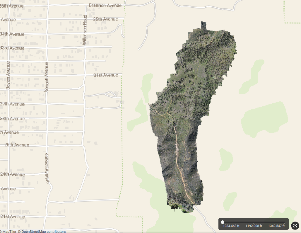
A zoomed out look at a large orthomosaic.
Think of it like this: imagine taking hundreds of photographs of a puzzle from above, each one slightly overlapping the next, and then using software to blend them all together into one seamless, high-resolution picture. That's essentially what an orthomosaic is. It gives us an incredibly detailed visual snapshot of a project area, showing the vegetation, the terrain, and the overall landscape conditions at a specific moment in time. And because we're capturing it ourselves, the imagery is always current.
How Does This Help Work on the Ground?
In a few really important ways.
When we're coordinating with contractors who will be doing the vegetation management work, we can share these detailed aerial views so they know exactly what to expect before they arrive. Instead of describing the density of a hillside covered in manzanita over the phone, we can just show them. That kind of visual context helps contractors plan their approach, estimate their timelines, and figure out how to allocate their crews. It takes a lot of the guesswork out of the equation.
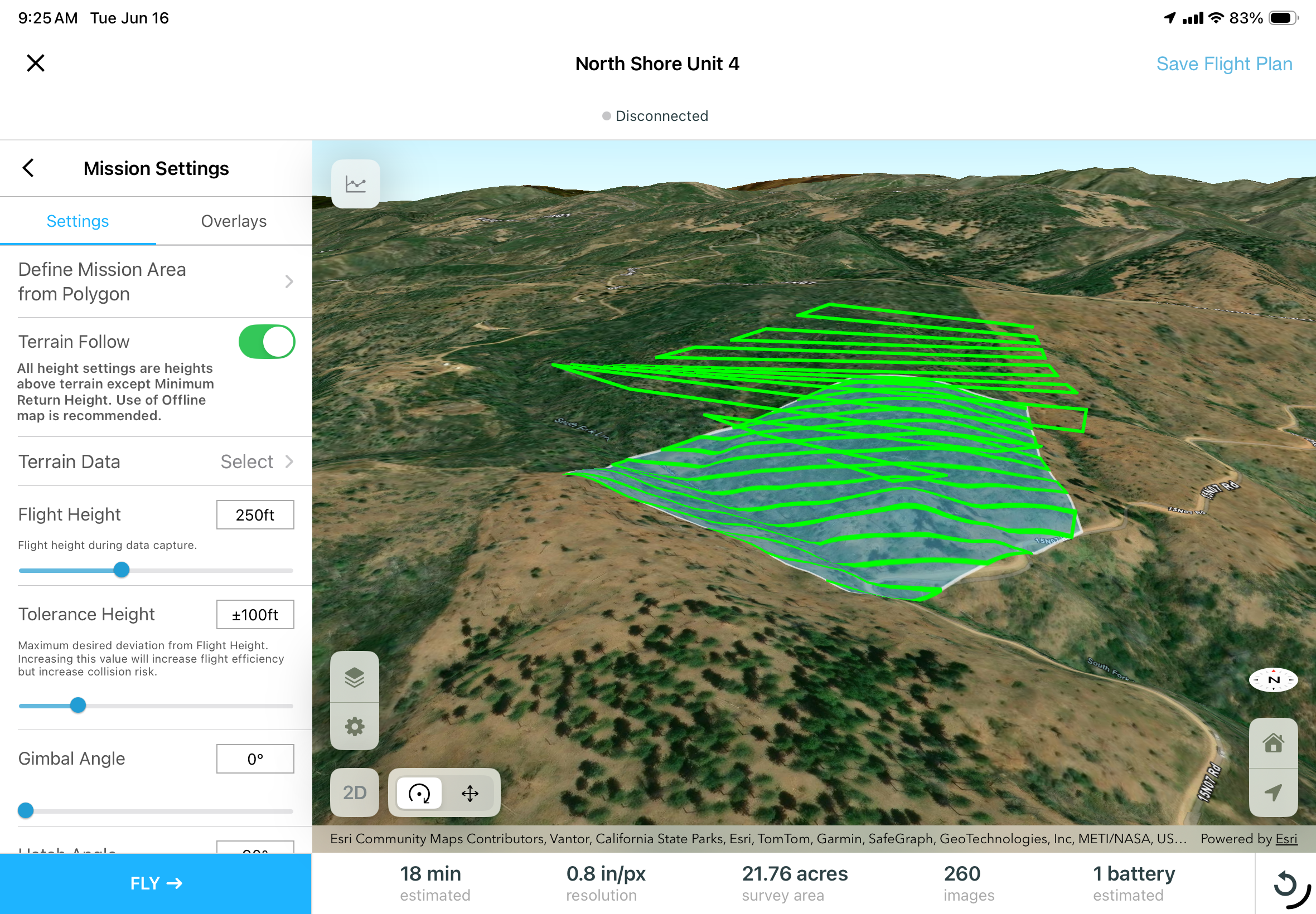
Drone flight planning is the first step for automated flights.
We also capture orthomosaics both before work begins and after it's completed. Those before-and-after visuals give us a clear, detailed record of the progress being made, which goes a long way in strengthening our grant reporting. We can show funders exactly what their investment accomplished in vivid, high-resolution imagery rather than relying on descriptions alone.
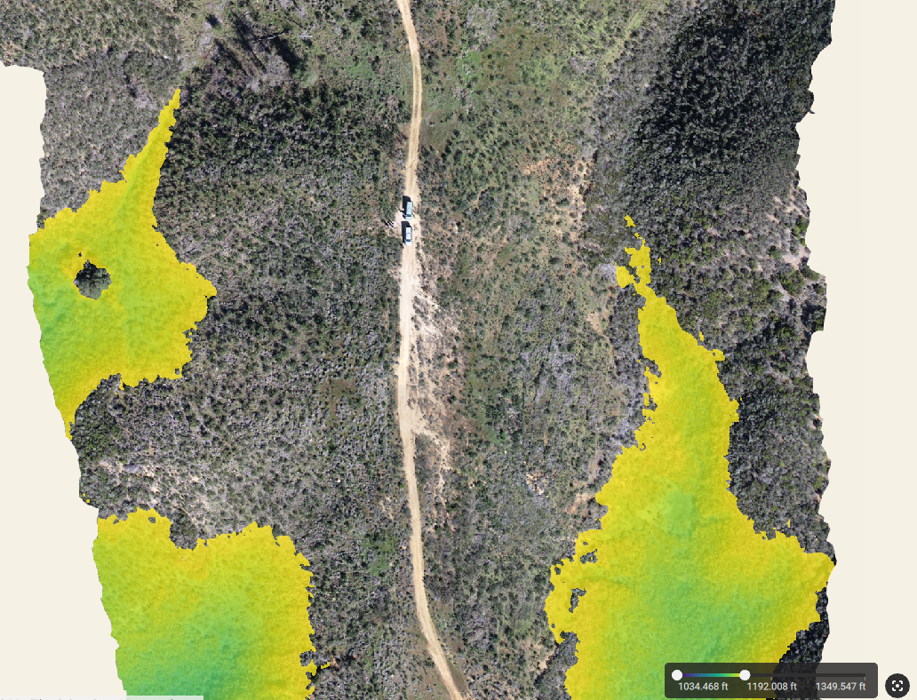
And because these images are timestamped records of landscape conditions, they become useful research tools over time. By comparing orthomosaics from different seasons or years, we can observe how vegetation responds after treatment, track regrowth patterns, and watch how the landscape changes. That kind of long-term visual data helps us make smarter decisions about future project planning and contributes to a better understanding of forest health across the region.
Is This All Done Safely and Legally?
Absolutely. All drone flights are conducted by an FAA-certified Part 107 Remote Pilot and follow federal aviation regulations to the letter. Safety is built into every step, from pre-flight planning and airspace checks to on-site protocols during each flight. This is a carefully managed research tool operating under the same regulations that govern commercial drone operations across the country.
The Bigger Picture
The drone program is just one piece of a much larger effort. CLERC's Fire & Forestry Program is actively coordinating vegetation management, fuel break creation, roadside clearing, reforestation, and community fire safety projects all across Lake County. From the Mt. Konocti Fuel Interface and Point Lakeview to High Valley Road, Bottle Rock Road, Panorama & Sunrise Shores, Clearlake Avenues, and beyond, the scope of this work continues to grow as new funding and community needs come together.
Since 2015, more than seventy-five percent of Lake County has been affected by wildfire. That's a staggering number, and it's exactly why this work matters so much. Every project area cleared, every fuel break completed, and every roadside managed makes our communities a little safer and our landscapes a little healthier.
Here's Where You Come In
Many of these projects take place on or near private property, and we need signed Right of Entry forms from property owners before our crews can begin. It's a quick, simple process, the agreement is temporary, and all the work is done at absolutely no cost to you.
Want to see if your property is in an active or upcoming project area? Head over to theclerc.org/right-of-entry, check the interactive maps, and if you're included, sign your ROE today. Your signature helps connect the work across properties into a continuous line of fire defense for your entire neighborhood.
Questions? Reach out to us anytime at documents@theclerc.org, call 707-261-0008, or stop by our office at 125 Park Street in downtown Lakeport.